Bywater Creek, Tasmania
Bywater Creek is a minor waterway in the Huon Valley, approximately three kilometres south of Franklin, running seven kilometres from its headwaters in the western hills to its confluence with a Huon River tributary. Unremarkable in every respect that matters to anyone who does not farm the land it crosses — until a seasonal orchard worker walked its bank on the morning of 22 May 2018 and did not return.
A Creek Without a Story
Bywater Creek is a minor waterway in the Huon Valley, approximately three kilometres south of the township of Franklin and sixty kilometres south of Hobart. It runs for roughly seven kilometres from its headwaters in the low hills west of the Huon Highway to its confluence with a tributary of the Huon River east of the valley floor. For most of its length, it is narrow enough to step across in dry conditions and fast enough to drown in after sustained rain.
The creek has no entry in any published guide to Tasmanian waterways. It does not appear on tourist maps. It supports no recreational fishing, no swimming holes worth visiting, and no scenery that would justify pulling a car to the shoulder of the road to photograph. It is, in every respect that matters to anyone who does not farm the land it crosses, unremarkable.
The name appears in parish records from the 1840s, likely derived from an early settler family whose presence in the valley was brief enough that no other trace of them survives. Whether the Bywaters farmed the creek flats, logged the surrounding bush, or simply camped beside the water long enough for their name to attach itself to the landscape is not recorded. The creek kept the name and lost the family. It would not be the last time.
Geography and Hydrology
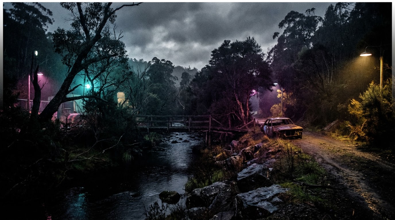
The creek's catchment is small — approximately twelve square kilometres of mixed farmland and remnant bushland on the valley's western slopes. The headwaters emerge from springs in a stand of wet eucalyptus forest at approximately 280 metres elevation, flowing east through increasingly cleared country before reaching the valley floor.
The upper reaches are steep and rocky, dropping through a series of small cascades that would be attractive in a larger waterway but are merely functional in one this size. Below the treeline, the gradient eases and the creek enters the pastoral landscape that defines the lower Huon Valley — apple orchards, grazing paddocks, and the occasional hobby farm whose owners commute to Hobart for work that pays better than anything the valley offers.
The creek's behaviour is governed entirely by rainfall. In summer, it can reduce to a chain of disconnected pools connected by a trickle that barely dampens the gravel bed. In autumn and winter, particularly after the sustained rains that characterise the Huon Valley's cooler months, the same creek becomes a fast-moving channel capable of carrying branches, fence debris, and anything else that enters its current downstream with enough force to make recovery difficult.
The banks are lined for most of the creek's lower length with dense peppermint scrub — Eucalyptus pulchella and Eucalyptus amygdalina — interspersed with blackwood, silver wattle, and the kind of opportunistic undergrowth that colonises any ground not actively cleared by farming. In places, the scrub extends to within a metre of the waterline. In others, where cattle have access to the creek for drinking water, the banks are bare clay worn into shallow terraces by hooves and erosion.
The creek bed itself is predominantly gravel and clay — material that takes boot impressions clearly after rain and surrenders them completely after the next downpour. Evidence left on the creek banks has a limited shelf life, measured in days rather than weeks, and anything entering the water is subject to forces that move objects downstream without respect for their investigative significance.
The Farming Country
The land through which Bywater Creek passes has been farmed continuously since the 1840s, though the nature of that farming has shifted with each generation's economic circumstances. The original grants — parcels of fifty to a hundred acres allocated to free settlers and emancipists — supported mixed agriculture: vegetables, grain, livestock, and the apple orchards that would eventually define the Huon Valley's identity and economy.
By the early twentieth century, apples dominated. The valley's combination of reliable rainfall, deep alluvial soils, and relatively mild temperatures proved ideal for varieties including Sturmer, Cleopatra, and Cox's Orange Pippin, and the Huon's orchards exported fruit to Britain in quantities that made apple-growing the closest thing the valley had to an industry.
The apple boom's decline — accelerated by Britain's entry into the European Economic Community in 1973, which redirected British fruit imports toward European suppliers — left the valley's farming families with orchards that produced fruit nobody was paying a profitable price for. Some diversified into stone fruit, berries, or wine grapes. Some sold to hobby farmers and lifestyle block purchasers from Hobart. Some held on, thinning their orchards, reducing their workforce, and accepting seasonal prices that made employment increasingly casual and increasingly dependent on workers willing to accept what was offered.
The properties along Bywater Creek reflect this trajectory. The Velt orchard, which sits on the creek's northern bank approximately 800 metres downstream from the treeline, is one of several working orchards in the immediate area that survived the industry's contraction by reducing scale rather than abandoning production. Barry Velt's family has worked the property since the 1920s. The current operation runs to approximately forty hectares of apples and pears, supplemented by a small beef cattle herd that grazes the paddocks too steep or too shaded for productive fruit.
The property's infrastructure includes the main farmhouse — a weatherboard cottage built in the 1930s and extended piecemeal over subsequent decades — a packing shed, equipment storage, and the converted shearing shed that serves as workers' quarters during the picking and pruning seasons. The workers' quarters sit approximately two hundred metres from the farmhouse, separated by an equipment yard and a row of mature poplars that effectively screen the two buildings from each other's view.
A track follows the creek from the workers' quarters downstream for approximately a kilometre before the terrain becomes too overgrown and the bank too steep for comfortable walking. The track is not formed or maintained — it exists because people and cattle have walked it often enough over enough decades to compress the undergrowth into something resembling a path. It leads to no particular destination. It simply follows the water until the bush decides it has gone far enough.
The Disused Irrigation Shed
Approximately 150 metres downstream from the section of the track where the path passes closest to the creek's edge, a corrugated iron shed sits in a clearing created by the removal of several peppermint trees at some point in the 1970s or early 1980s. The shed was built to house a diesel pump that drew water from the creek for orchard irrigation — a system installed by Barry Velt's father and operated until the late 1990s, when the property connected to the valley's reticulated irrigation scheme and the creek pump became redundant.
The shed measures approximately four metres by three metres. Its walls are corrugated iron fixed to a timber frame whose posts have begun to lean with the combined effects of soil movement and inadequate maintenance. The roof, also corrugated iron, retains most of its sheets but admits water through gaps where fixings have rusted through. The diesel pump remains inside — a squat, rust-seized block of cast iron that would require more effort to remove than anyone has considered it worth.
The shed has no lock. Its door — a single sheet of corrugated iron on strap hinges — can be pulled shut but not secured. The area behind the shed, between the rear wall and the dense scrub that begins approximately five metres from the structure, is a flat patch of bare earth that receives neither direct sunlight nor sufficient drainage to support vegetation. It is the kind of space that exists because two features — a building and a tree line — happen to be positioned in a way that creates a gap, and that nobody has found a purpose for beyond the occasional storage of materials not worth storing properly.
In May 2018, this unremarkable patch of ground behind an unremarkable shed became the site of evidence that suggested something had happened to Isaac Fairburn that was not consistent with a voluntary departure.
The Creek in Autumn
The Huon Valley in late May sits on the cusp of winter. Daylight contracts to fewer than ten hours. Morning frosts are common on the valley floor, though the creek's immediate surroundings — sheltered by scrub and warmed marginally by the water's retained heat — remain a degree or two above freezing on all but the coldest nights.
Rainfall in May 2018 was above average for the valley. The Bureau of Meteorology's nearest gauge, at Grove approximately fifteen kilometres north, recorded 127 millimetres for the month — enough to keep the creek running at a level that submerged its gravel bars and turned its clay banks into surfaces that held impressions for days but could be wiped clean by a single heavy downpour.
The creek on 22 May 2018 — the morning Isaac Fairburn walked its bank for the last time — was running high enough to be audible from the track but not so high as to present any danger to a person walking alongside it. The water was clear over the gravel runs and opaque brown in the deeper pools where clay sediment suspended in the current reduced visibility to centimetres.
The conditions were, in short, precisely the kind that would preserve evidence on the banks while destroying anything that entered the water. The creek offered investigators a partial record of what had happened on its margins and nothing at all about what may have passed through its current.
After May 2018
Bywater Creek continues to flow through the Velt property and the farming country south of Franklin in the same manner it has flowed for millennia — rising with the rains, falling in the dry months, carrying whatever enters its current downstream without discrimination or memory.
The track along its bank remains. The irrigation shed remains. The flat patch of ground behind the shed, where boot impressions and drag marks once told a story whose ending nobody has been able to read, has been rained on, frozen, thawed, dried, and rained on again through enough seasons to ensure that whatever the earth once held is now indistinguishable from the ordinary compression of soil under weather.
Barry Velt continues to operate the orchard. Seasonal workers continue to occupy the converted shearing shed during picking and pruning seasons. Some of them walk the creek track in the mornings, as Isaac Fairburn did, though whether any of them know what happened on the track in May 2018 depends on whether Barry Velt mentions it, which he generally does not.
The creek kept what it took. Nobody has come to claim it back.