Cambridgeshire, England
Cambridgeshire is a ceremonial county in the East of England, bordered by Lincolnshire, Norfolk, Suffolk, Essex, Hertfordshire, Bedfordshire, and Northamptonshire. Covering 3,389 square kilometres of predominantly flat terrain — the northern and eastern reaches dominated by the drained Fenland, including Britain's lowest point at Holme Fen — the county has been shaped by the interplay of water and human endeavour across four millennia. Its county town, Cambridge, is home to the University of Cambridge, founded in 1209, whose thirty-one colleges have produced 126 Nobel laureates.
Landscape and Boundaries
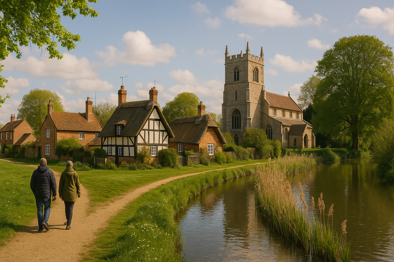
Cambridgeshire lies in the East of England, a largely flat county of 3,389 square kilometres with an estimated population of 906,814 in 2022. Its two largest settlements are the city of Peterborough in the north-west and the city of Cambridge in the south; the remainder is overwhelmingly rural, with the cathedral city of Ely to the east, the port town of Wisbech in the north-east, and the market towns of Huntingdon and St Neots in the west. The county is bordered by Lincolnshire to the north, Norfolk to the north-east, Suffolk to the east, Essex and Hertfordshire to the south, Northamptonshire to the west, and Bedfordshire to the south-west.
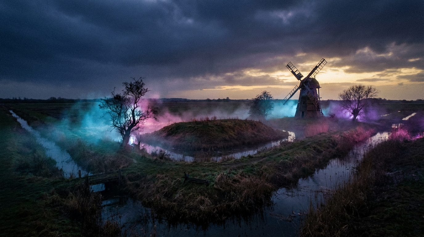
The defining geographical feature is the Fens — vast tracts of flat, drained marshland that dominate the north and east of the county. Before the great drainage campaigns of the seventeenth century, these were freshwater wetlands criss-crossed by rivers and dotted with islands of higher ground on which settlements clung. Today the peat and silt soils of the Fens produce some of the most productive agricultural land in England, though the draining of the peat has caused severe shrinkage: Holme Fen, south of Peterborough, is the lowest physical point in the United Kingdom, lying 2.75 metres below sea level. The south of the county is gently rolling chalk downland, rising to the Gog Magog Hills — modest by most standards but, at around seventy-five metres, the highest ground in the area. The principal rivers are the Cam, the Great Ouse, and the Nene, all of which drain into the Wash via the Fens.
Before the Romans
Cambridgeshire contains some of the most important prehistoric sites in Britain. Flag Fen, east of Peterborough, is one of the earliest-known permanent settlements in the United Kingdom, a Bronze Age site constructed around 3,500 years ago from more than sixty thousand timbers arranged in five long rows to form a wooden causeway nearly a kilometre long across the wet fenland, with a small artificial island of apparent religious significance at its centre. Must Farm quarry, at Whittlesey, has been described as Britain's Pompeii — a settlement preserved in extraordinary detail after a catastrophic fire around 850 BC, yielding the best-preserved Bronze Age dwellings ever discovered in the country, complete with textiles, tools, and food still inside their vessels. Extensive Stone Age, Bronze Age, and Iron Age finds have been made across East Cambridgeshire, with the greatest concentration at Isleham.
Romans, Angles, and Danes
The Romans built the fort of Duroliponte on Castle Hill at Cambridge around AD 70, connected to Ermine Street by Akeman Street, and the settlement thrived as a civilian town with road and river access. Across the wider county, Roman farmsteads, roads, and tile kilns have been found, though the Fens themselves remained largely uninhabited in the Roman period, their waterlogged margins used for seasonal grazing and fishing. Following the Roman withdrawal around 410, Anglo-Saxon settlers occupied the area from the fifth century onward, and the Tribal Hidage records the names of the Fenland peoples: the North Gyrwe around Peterborough and Crowland, the South Gyrwe around Ely, and the Spalda around Spalding. The county was recorded in the Domesday Book of 1086 as Grantbridgeshire — the shire of Grantbridge — with 152 places listed under the survey.
The Danes arrived at Cambridge in 875 and imposed the Danelaw by 878, making the town an important trading centre. Danish rule lasted some forty years before the town submitted to King Edward the Elder in 921. In 870, Danish raiders had destroyed the great abbey at Ely, founded in 673 by the East Anglian princess Æthelthryth on an island of Kimmeridge clay rising above the surrounding marshes — a site whose name, first recorded by the Venerable Bede, means island of eels. The abbey lay desolate for nearly a century before it was refounded around 970 as a Benedictine monastery under King Edgar and Bishop Æthelwold of Winchester, with fisheries that yielded 3,750 eels annually at Domesday.
Hereward, the Cathedral, and the Bishop's Liberty
In 1070, following the Norman Conquest, the Anglo-Saxon thegn Hereward the Wake used the Isle of Ely as a stronghold for his resistance against William the Conqueror, exploiting the impassable wetlands to shelter a force that included Earl Morcar of Northumbria and Danish allies. William responded by constructing a timber causeway across the marshes at Aldreth, and the island fell in 1071 after monks betrayed a secret ford to the besiegers. William exacted a heavy price: Ely had been the second richest monastery in England, and its monks were forced to melt down and sell their gold and silver to buy pardon.
The foundations of the present Ely Cathedral were laid by the first Norman abbot, Simeon, between 1083 and 1094. The cathedral, built on its elevation above the Fens, is visible for miles across the flat landscape and has been known since the Middle Ages as the Ship of the Fens. Its most celebrated feature is the octagonal lantern tower, constructed by the sacrist Alan of Walsingham after the original Norman crossing tower collapsed in 1322 — an engineering feat that the architectural historian Nikolaus Pevsner described as the greatest individual achievement of architectural genius at Ely. The bishopric, created in 1109, exercised extraordinary temporal authority over the Isle of Ely through the Liberty of Ely, appointing its own chief justice and excluding the king's sheriffs, until the Liberty of Ely Act of 1837 brought these feudal powers to an end.
Draining the Fens
The transformation of the Cambridgeshire landscape from waterlogged marshland to productive farmland is one of the greatest feats of civil engineering in English history. Although some Roman hydraulic works survive and medieval monks maintained local drainage channels, the systematic draining of the Great Level began in the 1630s under Francis Russell, fourth Earl of Bedford, who assembled a syndicate of investors — the Adventurers — and employed Dutch expertise to cut channels linking the Great Ouse to the sea at King's Lynn. Two great artificial rivers were dug: the Old Bedford River and the New Bedford River, also known as the Hundred Foot Drain. Cornelius Vermuyden, the Dutch engineer, was brought in for the second phase of construction in the 1650s, using labour that included Scottish and Dutch prisoners of war.
The drainage was bitterly opposed by the Fenland people, whose livelihoods depended on fishing, wildfowling, and reed-cutting. The resisters, known as Fen Tigers, sabotaged dykes, ditches, and sluices. During the Civil War, Parliamentary forces broke Vermuyden's works to flood the land and prevent a Royalist advance, and it was not until 1649 that the work resumed. The final conquest of the Fens came in the 1820s, when coal-powered steam engines replaced the windpumps that had proved inadequate to hold back the water. An unforeseen consequence of drainage was the oxidation and shrinkage of the exposed peat, causing the land to sink dramatically — in some places by as much as six metres — so that much of the Fens now lies below high tide level and depends entirely on artificial pumping. Wicken Fen, preserved as the first National Nature Reserve in England, offers a glimpse of the landscape as it existed before the great drainage transformed it.
The Making of the Modern County
For centuries, the historic county of Cambridgeshire and the Isle of Ely functioned as separate administrative entities, reflecting the Isle's long tradition of independence under episcopal rule. The Local Government Act 1888 created four neighbouring administrative counties in the area: Cambridgeshire, the Isle of Ely, Huntingdonshire, and the Soke of Peterborough (the last being administratively part of Northamptonshire). In 1965, Cambridgeshire and the Isle of Ely were merged into a single administrative county, and in 1974, under the Local Government Act 1972, this was further amalgamated with Huntingdon and Peterborough to form the present Cambridgeshire. Since 1998, the City of Peterborough has been separately administered as a unitary authority, though it remains part of Cambridgeshire for ceremonial purposes. The remainder of the county is governed by Cambridgeshire County Council and divided into five districts: Cambridge, East Cambridgeshire, Fenland, Huntingdonshire, and South Cambridgeshire.
The county's economy reflects its divided character. The Fens remain overwhelmingly agricultural, producing wheat, sugar beet, potatoes, and vegetables on some of the most fertile land in England. Wisbech, on the River Nene, is the county's only surviving port. In the south, the proximity of the University of Cambridge has spawned the technology cluster known as Silicon Fen, centred on the Cambridge Science Park established by Trinity College in 1970, and home to companies specialising in software, biotechnology, artificial intelligence, and pharmaceuticals. The Cambridge Biomedical Campus, anchored by Addenbrooke's Hospital, is one of the largest centres of medical research in Europe. The county's educational heritage extends beyond the university: King's Ely, founded in 970, and Wisbech Grammar School, established in 1379, are among the oldest schools in England.
The county town of Cambridge — home to the University of Cambridge and its thirty-one colleges since 1209 — stands at the heart of Cambridgeshire's identity, a place where eight centuries of scholarship have shaped a city, a county, and a landscape that bears the marks of every era from Bronze Age causeways to modern science parks.